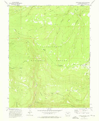
1973 Map of Starvation Point
USGS Topo · Published 1976About this map
The Uncompahgre National Forest dominates this mid-1970s survey of the high plateaus along the boundary of Mesa and Montrose counties. This high-altitude landscape is defined by its seasonal grazing and resource extraction, anchored by the Fortyseven Cow Camp and the Columbine Guard Sta. To the south, the Copper King Mine overlooks Tabeguache Creek, while prominent landmarks like Starvation Point and The Tongue of Starvation mark the dramatic drop into the Tabeguache Basin.
Find a feature on this map
40 named features on this map. Tap any name to fly to it.
Don’t see what you’re looking for? This feature index may not catch every label — zoom into the map to look around manually.
Map Details
Editions of this 1973 Starvation Point Map
This is the sole edition of this map. No revisions or reprints were ever made.
Other maps of this area

1916 · Paradox Valley
USGS Topo · 1:125,000

1922 · Paradox Valley
USGS Topo · 1:125,000

1956 · Moab
USGS Topo · 1:250,000

1959 · Moab
USGS Topo · 1:250,000

1960 · Moab
USGS Topo · 1:250,000
1960 · Nucla
USGS Topo · 1:24,000
1960 · Nucla
USGS Topo · 1:62,500
1960 · Windy Point
USGS Topo · 1:24,000

1962 · Moab
USGS Topo · 1:250,000

1964 · Moab
USGS Topo · 1:250,000