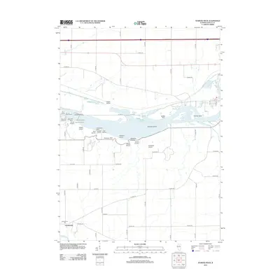
2012 Map of Starved Rock
USGS Topo · Published 2012About this map
Starved Rock and its surrounding bluffs dominate this section of the Illinois River valley, where deep ravines and geological overlooks define the southern bank. The map reveals a dense concentration of named natural features, including French Canyon, Tonti Canyon, and LaSalle Canyon, leading to vantage points like Lovers Leap Overlook. This landscape is shaped by the water, with the Vermilion River joining the Illinois near the settlement of Vermilionville. To the south, the terrain levels into the agricultural grid of LaSalle County, while the river itself is punctuated by major landforms such as Buffalo Rock and several islands, including Plum Island and Leopold Island. The presence of the Vermillionville Cem offers a specific point of interest for those researching local family history in this corner of the Illinois valley.
Find a feature on this map
60 named features on this map. Tap any name to fly to it.
Don’t see what you’re looking for? This feature index may not catch every label — zoom into the map to look around manually.
Map Details
Editions of this 2012 Starved Rock Map
This is the sole edition of this map. No revisions or reprints were ever made.
Other maps of this area

1892 · Ottawa
USGS Topo · 1:62,500

1893 · Lasalle
USGS Topo · 1:62,500

1911 · La Salle
USGS Topo · 1:62,500

1913 · La Salle
USGS Topo · 1:62,500

1915 · Ottawa
USGS Topo · 1:62,500

1925 · Streator
USGS Topo · 1:62,500

1927 · Streator
USGS Topo · 1:62,500

1934 · Wenona
USGS Topo · 1:48,000

1939 · Wenona
USGS Topo · 1:62,500

1946 · Ottawa
USGS Topo · 1:62,500