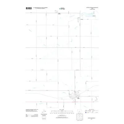
2013 Map of State Center
USGS Topo · Published 2013About this map
State Center sits at the intersection of long-distance transport and local agriculture in this Marshall County landscape. The map highlights the town's grid anchored by the historical Lincoln Hwy, while the surrounding township remains defined by its section-line roads and numerous watercourses. The northern portion of the quadrangle shows the small settlements of Saint Anthony, Clemons, and Bromley, each situated near the winding paths of Middle Minerva Cr and S Minerva Cr. In the south, the headwaters of the N Skunk River begin to take shape among a network of drainage that includes Linn Cr and N Timber Cr. This survey illustrates the persistent importance of the 19th-century township grid in 21st-century Iowa, where named avenues like Binford Ave and Eastman Ave continue to organize the rural space between these historic prairie communities.
Find a feature on this map
53 named features on this map. Tap any name to fly to it.
Don’t see what you’re looking for? This feature index may not catch every label — zoom into the map to look around manually.
Map Details
Editions of this 2013 State Center Map
This is the sole edition of this map. No revisions or reprints were ever made.
Other maps of this area

1954 · Waterloo
USGS Topo · 1:250,000

1954 · Des Moines
USGS Topo · 1:250,000

1955 · Waterloo
USGS Topo · 1:250,000

1956 · Des Moines
USGS Topo · 1:250,000

1957 · Des Moines
USGS Topo · 1:250,000

1969 · Des Moines
USGS Topo · 1:250,000

1975 · State Center NW
USGS Topo · 1:24,000

1975 · State Center
USGS Topo · 1:24,000

1975 · Union
USGS Topo · 1:24,000

1975 · Rhodes
USGS Topo · 1:24,000