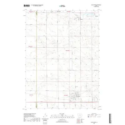
2018 Map of State Center
USGS Topo · Published 2018About this map
State Center serves as the focal point of this rural Marshall County landscape, characterized by the grid-work of township sections and the winding paths of several regional waterways. The town's detailed street plan includes local landmarks such as Saint Josephs Cem and Hillside Cem, while smaller settlements like St. Anthony, Clemons, and Bromley anchor the northern reaches. The terrain is defined by the drainage systems of the N Skunk River and several branches of Minerva Creek, including S Minerva Cr and Middle Minerva Cr. These watercourses create natural variations in the otherwise orderly agricultural landscape, where numerous family-named cemeteries like Saint Johns Cem and Sacred Hearts Cem suggest a deeply rooted community history. The interplay between the established town centers and the rural road network, including Main Street Rd, reflects the area's long-standing role as an Iowa agricultural hub.
Find a feature on this map
88 named features on this map. Tap any name to fly to it.
Don’t see what you’re looking for? This feature index may not catch every label — zoom into the map to look around manually.
Map Details
Editions of this 2018 State Center Map
This is the sole edition of this map. No revisions or reprints were ever made.
Other maps of this area

1954 · Waterloo
USGS Topo · 1:250,000

1954 · Des Moines
USGS Topo · 1:250,000

1955 · Waterloo
USGS Topo · 1:250,000

1956 · Des Moines
USGS Topo · 1:250,000

1957 · Des Moines
USGS Topo · 1:250,000

1969 · Des Moines
USGS Topo · 1:250,000

1975 · State Center NW
USGS Topo · 1:24,000

1975 · State Center
USGS Topo · 1:24,000

1975 · Union
USGS Topo · 1:24,000

1975 · Rhodes
USGS Topo · 1:24,000