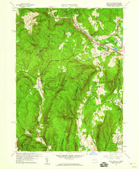
1959 Map of State Line
USGS Topo · Published 1960About this map
Richmond Furnace and the village of State Line anchor this 1959 survey of the borderlands between New York and Massachusetts. The map reveals a landscape shaped by historical extraction, notably at Hudson Ore Bed Pond and Lee Ore Bed Pond, which mark the sites of former iron mining operations near the Richmond town line. Transportation networks dominate the northern corridor, where the New York Central railroad and the Massachusetts Toll Road cut through the hills near Edwards Park.
Find a feature on this map
64 named features on this map. Tap any name to fly to it.
Don’t see what you’re looking for? This feature index may not catch every label — zoom into the map to look around manually.
Map Details
Editions of this 1959 State Line Map
2 editions found
Other maps of this area

1885 · Sheffield
USGS Topo · 1:62,500

1888 · Sheffield
USGS Topo · 1:62,500

1888 · Pittsfield
USGS Topo · 1:62,500

1890 · Pittsfield
USGS Topo · 1:62,500

1891 · Sheffield
USGS Topo · 1:62,500

1893 · Sheffield
USGS Topo · 1:62,500

1893 · Pittsfield
USGS Topo · 1:62,500

1894 · Pittsfield
USGS Topo · 1:62,500

1897 · Pittsfield
USGS Topo · 1:62,500

1897 · Sheffield
USGS Topo · 1:62,500