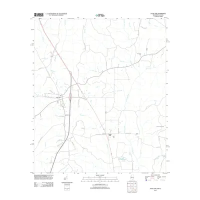
2012 Map of State Line
USGS Topo · Published 2012About this map
The Escataupa River and its numerous tributaries, including Brushy Cr, Pine Log Br, and Red Bank Cr, define this borderland landscape between Mississippi and Alabama. This 2012 survey details the small settlements of State Line, Yellow Pine, and Eret, providing a clear look at local infrastructure during the early 21st century. The map is particularly useful for genealogical research, identifying several burial sites such as State Line Cem, Union Cem, Yellow Pine Cem, and Gilley Cem. Industrial and utility land use is evident through the presence of the Chatom Gas Field and the Milstead Lookout Tower. Water resources are further highlighted by the Scott Paper Company Pond and Coaker Pond, while a network of rural roads like Gravel Hill Rd and State Line Copeland Rd connect the scattered homesteads and timberlands across the state boundary.
Find a feature on this map
69 named features on this map. Tap any name to fly to it.
Don’t see what you’re looking for? This feature index may not catch every label — zoom into the map to look around manually.
Map Details
Editions of this 2012 State Line Map
This is the sole edition of this map. No revisions or reprints were ever made.
Other maps of this area

1953 · Hattiesburg
USGS Topo · 1:250,000

1958 · Hattiesburg
USGS Topo · 1:250,000

1964 · Knobtown
USGS Topo · 1:24,000

1964 · Clark
USGS Topo · 1:24,000

1964 · Buckatunna
USGS Topo · 1:24,000

1974 · Fruitdale
USGS Topo · 1:24,000

1974 · Millry South
USGS Topo · 1:24,000

1974 · Chatom
USGS Topo · 1:24,000

1974 · State Line
USGS Topo · 1:24,000

1974 · Copeland
USGS Topo · 1:24,000