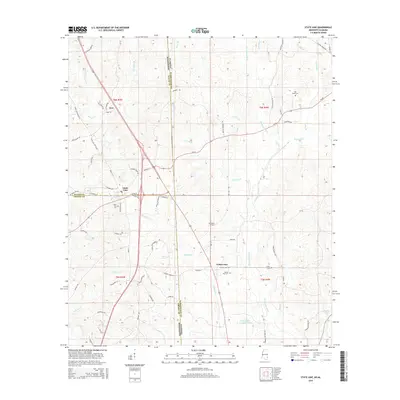
2015 Map of State Line
USGS Topo · Published 2015About this map
The Escatawpa River defines the central topography of this borderland, where the state lines of Mississippi and Alabama converge at the junction of Wayne, Greene, and Washington counties. The town of State Line serves as a hub for the surrounding pine lands, supported by smaller settlements like Yellow Pine and the community of Eret to the northwest. This 2015 survey reveals a landscape deeply connected to local genealogy and forestry, evidenced by the Scott Paper Company Pond and a dense network of family-named roads such as Loper Settlement Rd, Calvin Johnson St, and Charlie Goree Rd. Genealogists will find a significant concentration of burial sites throughout the quadrangle, including State Line Cem, Red Bank Cem, Yellow Pine Cem, and the more secluded Gilley Cem. Numerous tributaries, including Brushy Cr and Pine Log Br, weave through the terrain, illustrating the complex hydrology of the Gulf Coastal Plain.
Find a feature on this map
76 named features on this map. Tap any name to fly to it.
Don’t see what you’re looking for? This feature index may not catch every label — zoom into the map to look around manually.
Map Details
Editions of this 2015 State Line Map
This is the sole edition of this map. No revisions or reprints were ever made.
Other maps of this area

1953 · Hattiesburg
USGS Topo · 1:250,000

1958 · Hattiesburg
USGS Topo · 1:250,000

1964 · Knobtown
USGS Topo · 1:24,000

1964 · Clark
USGS Topo · 1:24,000

1964 · Buckatunna
USGS Topo · 1:24,000

1974 · Fruitdale
USGS Topo · 1:24,000

1974 · Millry South
USGS Topo · 1:24,000

1974 · Chatom
USGS Topo · 1:24,000

1974 · State Line
USGS Topo · 1:24,000

1974 · Copeland
USGS Topo · 1:24,000