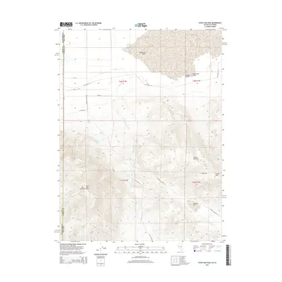
2014 Map of State Line Peak
USGS Topo · Published 2014About this map
The high desert terrain of the California and Nevada border is defined by the prominent peaks and arid basins of Washoe Co and Lassen Co. Central to this landscape are the Virginia Mountains and the State Line Mountains, which rise sharply above the southern reaches of the Honey Lake Valley. Notable summits such as Ft Sage Peak, Vinegar Peak, and the distinctively named Sugarloaf provide orientation across this expanse of public and private lands. The scarcity of water is reflected in the distribution of intermittent sources, including Fish Springs, Coyote Spring, and Sheep Springs, while Newcome Lake sits in the southeastern portion of the quadrangle. Transport and access are limited to a sparse network of ranch and valley roads, most notably Winnemucca Ranch Rd and Fish Springs Rd, which skirt the bases of canyons like Rock Springs Canyon and Anderson Canyon.
Find a feature on this map
31 named features on this map. Tap any name to fly to it.
Don’t see what you’re looking for? This feature index may not catch every label — zoom into the map to look around manually.
Map Details
Editions of this 2014 State Line Peak Map
This is the sole edition of this map. No revisions or reprints were ever made.
Other maps of this area

1886 · Honey Lake
USGS Topo · 1:250,000

1886 · Granite Range
USGS Topo · 1:250,000

1890 · Sierraville
USGS Topo · 1:125,000

1891 · Honey Lake
USGS Topo · 1:250,000

1891 · Reno
USGS Topo · 1:125,000

1892 · Sierraville
USGS Topo · 1:125,000

1893 · Honey Lake
USGS Topo · 1:250,000

1893 · Reno
USGS Topo · 1:125,000

1894 · Granite Range
USGS Topo · 1:250,000

1894 · Sierraville
USGS Topo · 1:125,000