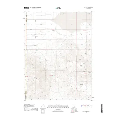
2018 Map of State Line Peak
USGS Topo · Published 2018About this map
State Line Peak and the high ridges of the Ft Sage Mountains dominate this 2018 survey along the Nevada and California border. The landscape transitions from the arid flats of the Honey Lake Valley in the north to the complex topography of the Virginia Mountains in the south. This area is defined by its seasonal water sources, with numerous named points such as Coyote Spring, Bull Spring, and Two Mile Spring scattered across the desert terrain. The presence of Newcome Lake and drainage through Fish Springs Cr suggests a classic Great Basin hydrologic pattern, where water is scarce and topographical high points like Vinegar Peak and Sugarloaf serve as primary landmarks. A sparse network of local roads, including Stateline Rd and Fish Springs Rd, provides limited access through the canyons and valleys of this remote high-desert environment.
Find a feature on this map
36 named features on this map. Tap any name to fly to it.
Don’t see what you’re looking for? This feature index may not catch every label — zoom into the map to look around manually.
Map Details
Editions of this 2018 State Line Peak Map
This is the sole edition of this map. No revisions or reprints were ever made.
Other maps of this area

1886 · Honey Lake
USGS Topo · 1:250,000

1886 · Granite Range
USGS Topo · 1:250,000

1890 · Sierraville
USGS Topo · 1:125,000

1891 · Honey Lake
USGS Topo · 1:250,000

1891 · Reno
USGS Topo · 1:125,000

1892 · Sierraville
USGS Topo · 1:125,000

1893 · Honey Lake
USGS Topo · 1:250,000

1893 · Reno
USGS Topo · 1:125,000

1894 · Granite Range
USGS Topo · 1:250,000

1894 · Sierraville
USGS Topo · 1:125,000