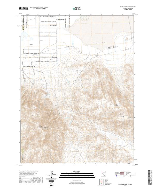
2021 Map of State Line Peak
USGS Topo · Published 2021About this map
Honey Lake Valley occupies the northern expanse of this 2021 survey, transitioning abruptly into the steep elevations of the Fort Sage Mountains and the Virginia Mountains. The landscape is defined by its water sources, with several vital points such as Gould Spring, Two Mile Spring, and Coyote Spring punctuating the arid terrain. The high peaks of Sugarloaf and Vinegar Peak overlook a network of rural routes that trace the base of the mountains, including Fish Springs Rd and State Line Rd. These roads and springs suggest a history of ranching and land use along the border of Nevada and California. The drainages of Fish Springs Cr and the deep cuts of Anderson Canyon illustrate the geological processes shaping this high-desert environment, where access to water has long determined the patterns of human movement.
Find a feature on this map
33 named features on this map. Tap any name to fly to it.
Don’t see what you’re looking for? This feature index may not catch every label — zoom into the map to look around manually.
Map Details
Editions of this 2021 State Line Peak Map
This is the sole edition of this map. No revisions or reprints were ever made.
Other maps of this area

1886 · Honey Lake
USGS Topo · 1:250,000

1886 · Granite Range
USGS Topo · 1:250,000

1890 · Sierraville
USGS Topo · 1:125,000

1891 · Honey Lake
USGS Topo · 1:250,000

1891 · Reno
USGS Topo · 1:125,000

1892 · Sierraville
USGS Topo · 1:125,000

1893 · Honey Lake
USGS Topo · 1:250,000

1893 · Reno
USGS Topo · 1:125,000

1894 · Granite Range
USGS Topo · 1:250,000

1894 · Sierraville
USGS Topo · 1:125,000