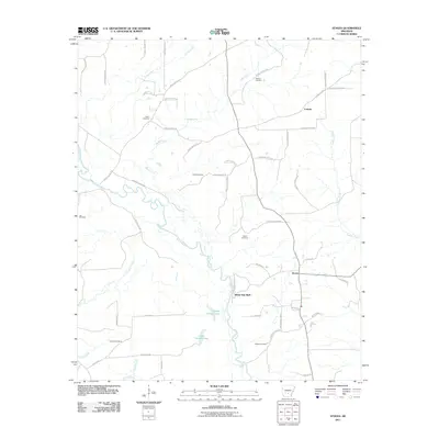
2011 Map of Staves
USGS Topo · Published 2011About this map
Saline River bottomlands and a network of logging roads define this pocket of Cleveland County, as recorded by the U.S. Geological Survey in the early 21st century. The landscape is characterized by its numerous small burial grounds, including Black Cemetery, Clement Cemetery, and Canada Cemetery, which reflect the area's rural genealogy and established family settlements. The community of Staves and the small hamlet of Lamont serve as the primary population centers, connected by a web of county and forestry routes like Forestry Road 9241. Distinctive hydrological features such as Upper Canada Lake and Lower Canada Lake are found near the river's winding course, shadowed by the prominent White Oak Bluff. This terrain suggests a long-standing reliance on timber and river resources, with many local roads named for the families and landmarks they serve, such as Mahoneys Ferry Rd and Killing Hse Rd.
Find a feature on this map
57 named features on this map. Tap any name to fly to it.
Don’t see what you’re looking for? This feature index may not catch every label — zoom into the map to look around manually.
Map Details
Editions of this 2011 Staves Map
This is the sole edition of this map. No revisions or reprints were ever made.
Other maps of this area

1953 · El Dorado
USGS Topo · 1:250,000

1955 · Little Rock
USGS Topo · 1:250,000

1956 · Little Rock
USGS Topo · 1:250,000

1957 · El Dorado
USGS Topo · 1:250,000

1958 · El Dorado
USGS Topo · 1:250,000

1960 · El Dorado
USGS Topo · 1:250,000

1960 · Little Rock
USGS Topo · 1:250,000

1962 · Pine Bluff NW
USGS Topo · 1:24,000

1962 · Kedron
USGS Topo · 1:24,000

1964 · Little Rock
USGS Topo · 1:250,000