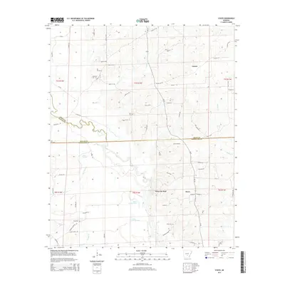
2014 Map of Staves
USGS Topo · Published 2014About this map
The Saline River meanders through the heart of this landscape, forming a complex hydrologic network of backwaters and oxbows including Upper Canada Lake and Lower Canada Lake. This 2014 survey captures the rural character of the region where the borders of Grant, Dallas, and Cleveland counties meet. The high ground of White Oak Bluff overlooks the river valley, while scattered settlements like Staves and Lamont anchor the local road network. The map is a significant resource for genealogists, documenting numerous small family and community burial grounds such as Wilson Cem, Black Cem, and Davis Cem. Smaller watercourses like Hurricane Cr and Mink Slough further define the drainage patterns of this timber-rich Arkansas bottomland.
Find a feature on this map
78 named features on this map. Tap any name to fly to it.
Don’t see what you’re looking for? This feature index may not catch every label — zoom into the map to look around manually.
Map Details
Editions of this 2014 Staves Map
This is the sole edition of this map. No revisions or reprints were ever made.
Other maps of this area

1953 · El Dorado
USGS Topo · 1:250,000

1955 · Little Rock
USGS Topo · 1:250,000

1956 · Little Rock
USGS Topo · 1:250,000

1957 · El Dorado
USGS Topo · 1:250,000

1958 · El Dorado
USGS Topo · 1:250,000

1960 · El Dorado
USGS Topo · 1:250,000

1960 · Little Rock
USGS Topo · 1:250,000

1962 · Pine Bluff NW
USGS Topo · 1:24,000

1962 · Kedron
USGS Topo · 1:24,000

1964 · Little Rock
USGS Topo · 1:250,000