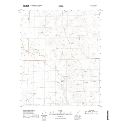
2020 Map of Staves
USGS Topo · Published 2020About this map
Saline River bottomlands define the geography of this Arkansas region, where the river winds through a complex system of sloughs and creeks. The landscape is marked by the distinct White Oak Bluff and water bodies including Upper Canada Lake and Lower Canada Lake. Family and community history is deeply rooted here, evidenced by numerous small burial grounds such as Lively Cem, Clement Cem, and Kennedy Cem scattered across the countryside. The unincorporated community of Staves serves as a central point in an area where the county lines of Grant, Dallas, and Cleveland meet. The extensive network of forestry roads, including Forestry Rd and Forest Rd 9205, suggests the continuing importance of timber and land management in this part of the state.
Find a feature on this map
75 named features on this map. Tap any name to fly to it.
Don’t see what you’re looking for? This feature index may not catch every label — zoom into the map to look around manually.
Map Details
Editions of this 2020 Staves Map
This is the sole edition of this map. No revisions or reprints were ever made.
Other maps of this area

1953 · El Dorado
USGS Topo · 1:250,000

1955 · Little Rock
USGS Topo · 1:250,000

1956 · Little Rock
USGS Topo · 1:250,000

1957 · El Dorado
USGS Topo · 1:250,000

1958 · El Dorado
USGS Topo · 1:250,000

1960 · El Dorado
USGS Topo · 1:250,000

1960 · Little Rock
USGS Topo · 1:250,000

1962 · Pine Bluff NW
USGS Topo · 1:24,000

1962 · Kedron
USGS Topo · 1:24,000

1964 · Little Rock
USGS Topo · 1:250,000