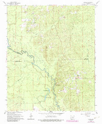
2024 Map of Staves
USGS Topo · Published 2024About this map
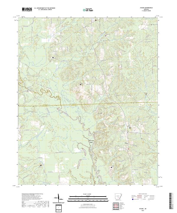
The Saline River cuts a winding path through this corner of Arkansas, defining the borders between Dallas, Grant, and Cleveland counties. The landscape is characterized by its dense network of waterways and low-lying drainage areas such as Mink Slough, Grisly Creek, and the oxbow formations of Upper Canada Lake and Lower Canada Lake. A notable elevation change occurs at White Oak Bluff, overlooking the river's path. Settlement patterns follow the higher ground away from the floodplains, concentrated around the community of Staves and the river crossing at Lees Ferry. For genealogists, the map is remarkably detailed with family-named landmarks and burial sites, including the Bell Family Cem, Clement Cem, and Kennedy Cem, which are scattered throughout the timberlands and rural road networks.
Find a feature on this map
74 named features on this map. Tap any name to fly to it.
Don’t see what you’re looking for? This feature index may not catch every label — zoom into the map to look around manually.
Map Details
Editions of this 2024 Staves Map
This is the sole edition of this map. No revisions or reprints were ever made.
Historical Maps of Lamont Through Time
6 maps found