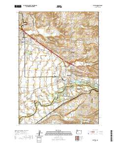
2020 Map of Stayton
USGS Topo · Published 2020About this map
The North Santiam River flows along the southern edge of this landscape, defining the boundary between Marion Co and Linn Co. The region is characterized by a network of drainage and irrigation features like Salem Ditch, Marion Ditch, and Mill Creek, which support the agricultural plains surrounding Stayton. Local history is deeply etched into the land through numerous small burial grounds, including the Anderson Lone Fir Pioneer Cemetery and the Shaw Catholic Cemetery.
Find a feature on this map
94 named features on this map. Tap any name to fly to it.
Don’t see what you’re looking for? This feature index may not catch every label — zoom into the map to look around manually.
Map Details
Editions of this 2020 Stayton Map
This is the sole edition of this map. No revisions or reprints were ever made.
Other maps of this area

1921 · Lebanon
USGS Topo · 1:62,500

1922 · Lebanon
USGS Topo · 1:48,000

1924 · Lebanon
USGS Topo · 1:62,500

1925 · Stayton
USGS Topo · 1:62,500

1940 · Lebanon
USGS Topo · 1:62,500

1941 · Stayton
USGS Topo · 1:62,500

1944 · Lebanon
USGS Topo · 1:62,500

1951 · Lyons
USGS Topo · 1:62,500

1951 · Snow Peak
USGS Topo · 1:62,500

1953 · Salem
USGS Topo · 1:250,000