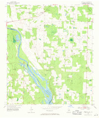
1954 Map of Steam Mill
USGS Topo · Published 1971About this map
The Chattahoochee River forms the primary geographic boundary of this 1950s survey, marking the state line between Georgia Florida and dividing Seminole Co Jackson Co. The landscape is dominated by the rising waters of the Jim Woodruff Reservoir, shown at its Normal Elevation 77. This hydraulic transformation altered the riverine environment near Steam Mill, a period when local infrastructure was still defined by rural community hubs such as St Johns Sch and Holy Neck Sch.
Find a feature on this map
28 named features on this map. Tap any name to fly to it.
Don’t see what you’re looking for? This feature index may not catch every label — zoom into the map to look around manually.
Map Details
Editions of this 1954 Steam Mill Map
2 editions found
Other maps of this area

1952 · Dellwood
USGS Topo · 1:24,000

1952 · Bascom
USGS Topo · 1:24,000

1953 · Dothan
USGS Topo · 1:250,000

1954 · Dothan
USGS Topo · 1:250,000

1954 · Steam Mill
USGS Topo · 1:24,000

1954 · Desser
USGS Topo · 1:24,000

1954 · Tallahassee
USGS Topo · 1:250,000

1955 · Dothan
USGS Topo · 1:250,000

1955 · Fairchild
USGS Topo · 1:24,000

1955 · Reynoldsville
USGS Topo · 1:24,000