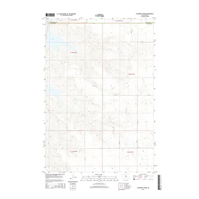
2015 Map of Steamboat Creek
USGS Topo · Published 2015About this map
The waters of Lake Oahe reach into the northwestern corner of this territory, where the boundary between Walworth Co and Potter Co is clearly defined. This landscape is shaped by the winding path of Steamboat Cr, which meanders eastward through several townships, including T120N R78W and T120N R77W. The map documents a structured rural grid of section lines and gravel roads, providing an essential record of land divisions in central South Dakota. While the reservoir shore represents a significant hydrological feature, the interior remains dominated by open terrain and local access routes like Akaska Rd and 299th Ave. Researchers can trace the drainage patterns of the creek and the intersection of various local roads, such as 152nd St and 301st Ave, which serve the agricultural parcels in this portion of the Missouri River valley region.
Find a feature on this map
19 named features on this map. Tap any name to fly to it.
Don’t see what you’re looking for? This feature index may not catch every label — zoom into the map to look around manually.
Map Details
Editions of this 2015 Steamboat Creek Map
This is the sole edition of this map. No revisions or reprints were ever made.
Other maps of this area

1953 · McIntosh
USGS Topo · 1:250,000

1958 · McIntosh
USGS Topo · 1:250,000

1968 · Akaska SW
USGS Topo · 1:24,000

1968 · Akaska
USGS Topo · 1:24,000

1968 · Moreau SE
USGS Topo · 1:24,000

1969 · Four Bear Creek
USGS Topo · 1:24,000

1969 · Patch Skin Buttes SE
USGS Topo · 1:24,000

1970 · Steamboat Creek
USGS Topo · 1:24,000

1970 · Lake Hurley
USGS Topo · 1:24,000

1970 · Lake Hurley NE
USGS Topo · 1:24,000