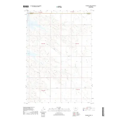
2017 Map of Steamboat Creek
USGS Topo · Published 2017About this map
Lake Oahe dominates the northwestern edge of this landscape in Potter County, its waters filling the Missouri River valley and creating distinct inlets like Steamboat Bay and Dodge Bay. The terrain inland is shaped by the winding course of Steamboat Cr, which carves through the prairie uplands before reaching the reservoir. This modern topographic survey illustrates the rural infrastructure of the region, where a network of section-line roads such as 148th St and 149th St grid the high ground between the drainage draws. The transition from the flat agricultural plateaus to the incised breaks along the water is captured in detail, including the remote path of Dodge Draw Rd as it descends toward the bay. The map also delineates the precise boundary between Walworth Co and Potter Co in the northern portion of the quadrangle.
Find a feature on this map
18 named features on this map. Tap any name to fly to it.
Don’t see what you’re looking for? This feature index may not catch every label — zoom into the map to look around manually.
Map Details
Editions of this 2017 Steamboat Creek Map
This is the sole edition of this map. No revisions or reprints were ever made.
Other maps of this area

1953 · McIntosh
USGS Topo · 1:250,000

1958 · McIntosh
USGS Topo · 1:250,000

1968 · Akaska SW
USGS Topo · 1:24,000

1968 · Akaska
USGS Topo · 1:24,000

1968 · Moreau SE
USGS Topo · 1:24,000

1969 · Four Bear Creek
USGS Topo · 1:24,000

1969 · Patch Skin Buttes SE
USGS Topo · 1:24,000

1970 · Steamboat Creek
USGS Topo · 1:24,000

1970 · Lake Hurley
USGS Topo · 1:24,000

1970 · Lake Hurley NE
USGS Topo · 1:24,000