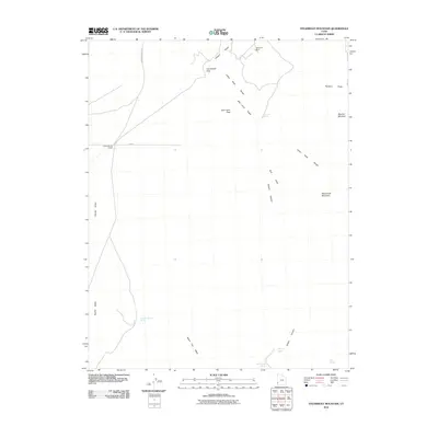
2010 Map of Steamboat Mountain
USGS Topo · Published 2010About this map
The Skougard Mine and Arrowhead Mine Rd indicate a landscape shaped by historical extraction efforts in this high-desert portion of Iron County. The terrain is dominated by the Indian Peak Range and the prominent Steamboat Mountain, with critical water sources such as Spanish George Spring, Mustang Spring, and Pace Spring serving as vital landmarks for navigation and land use. Several passes, including Arrowhead Pass and Bob Leroy Pass, dictate the movement across the mountain ridges. The map reveals a network of canyons and washes like Wilson Canyon and Negro Liza Wash that define the drainage patterns towards Hamlin Valley. This 2010 survey reflects a period when traditional mining and ranching interests, evidenced by features like the Pipeline Spring Trough and Butcher Meadow, continued to anchor the naming of this remote topography.
Find a feature on this map
21 named features on this map. Tap any name to fly to it.
Don’t see what you’re looking for? This feature index may not catch every label — zoom into the map to look around manually.
Map Details
Editions of this 2010 Steamboat Mountain Map
This is the sole edition of this map. No revisions or reprints were ever made.
Other maps of this area

1885 · St. George
USGS Topo · 1:250,000

1891 · St. George
USGS Topo · 1:250,000

1953 · Richfield
USGS Topo · 1:250,000

1953 · Cedar City
USGS Topo · 1:250,000

1958 · Richfield
USGS Topo · 1:250,000

1958 · Cedar City
USGS Topo · 1:250,000

1962 · Cedar City
USGS Topo · 1:250,000

1971 · Observation Knoll
USGS Topo · 1:24,000

1971 · Pinto Spring
USGS Topo · 1:24,000

1971 · Steamboat Mtn SW
USGS Topo · 1:24,000