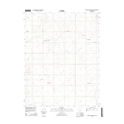
2014 Map of Steamboat Mountain SW
USGS Topo · Published 2014About this map
Hamlin Valley defines this high-desert basin near the border of Utah and Nevada, where seasonal drainages like Hamlin Valley Wash and Chokecherry Cr carve paths through the arid landscape. The area is marked by a network of ranching and utility roads, including the isolated RBR Ranch Rd and State Line Rd, which traces the political boundary at the edge of Iron County. Topographical landmarks such as Arrowhead Pass and Little Basket Rd suggest the practical routes used by locals to navigate the varied elevations. The map reveals a remote pastoral character where water sources like Pinto Cr are central to the geography of the western Great Basin, providing a clear view of the region's sparse infrastructure and rural land management just after the turn of the twenty-first century.
Find a feature on this map
20 named features on this map. Tap any name to fly to it.
Don’t see what you’re looking for? This feature index may not catch every label — zoom into the map to look around manually.
Map Details
Editions of this 2014 Steamboat Mountain SW Map
This is the sole edition of this map. No revisions or reprints were ever made.
Other maps of this area

1885 · St. George
USGS Topo · 1:250,000

1885 · Pioche
USGS Topo · 1:250,000

1886 · Pioche
USGS Topo · 1:250,000

1891 · St. George
USGS Topo · 1:250,000

1953 · Richfield
USGS Topo · 1:250,000

1953 · Cedar City
USGS Topo · 1:250,000

1954 · Caliente
USGS Topo · 1:250,000

1956 · Lund
USGS Topo · 1:250,000

1958 · Richfield
USGS Topo · 1:250,000

1958 · Cedar City
USGS Topo · 1:250,000