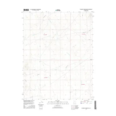
2017 Map of Steamboat Mountain SW
USGS Topo · Published 2017About this map
Hamlin Valley defines the landscape of this high-desert region on the Utah-Nevada border. The terrain is characterized by the broad drainage of the Hamlin Valley Wash, which flows north toward the Great Basin. To the west, the elevated State Line Bench marks the transition into the neighboring state, while the central portion of the sheet is dominated by the expansive Upper Basin. Modern land use and cattle ranching are evident through the network of utilitarian routes like R R Ranch Rd and access roads such as Arrowhead Mine Rd. Water sources remain critical in this arid environment, represented by seasonal flows like Chokecherry Cr and Pine Cr, along with specific watering points such as Hamlin Valley 5 Spr. This survey documents the cadastral divisions and remote infrastructure of Iron County at the start of the twenty-first century.
Find a feature on this map
14 named features on this map. Tap any name to fly to it.
Don’t see what you’re looking for? This feature index may not catch every label — zoom into the map to look around manually.
Map Details
Editions of this 2017 Steamboat Mountain SW Map
This is the sole edition of this map. No revisions or reprints were ever made.
Other maps of this area

1885 · St. George
USGS Topo · 1:250,000

1885 · Pioche
USGS Topo · 1:250,000

1886 · Pioche
USGS Topo · 1:250,000

1891 · St. George
USGS Topo · 1:250,000

1953 · Richfield
USGS Topo · 1:250,000

1953 · Cedar City
USGS Topo · 1:250,000

1954 · Caliente
USGS Topo · 1:250,000

1956 · Lund
USGS Topo · 1:250,000

1958 · Richfield
USGS Topo · 1:250,000

1958 · Cedar City
USGS Topo · 1:250,000