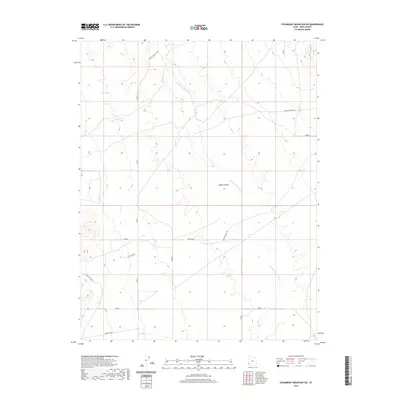
2020 Map of Steamboat Mountain SW
USGS Topo · Published 2020About this map
Hamlin Valley defines the core of this high-desert landscape in western Iron County, where the drainage of the Hamlin Valley Wash cuts through a broad basin. The map records a rural network of ranching and resource access roads, notably R R Ranch Rd and Arrowhead Mine Rd, which signal the area's history of mineral exploration and livestock operations. This 2020 record of the terrain shows the distinct geological transitions between the Upper Basin and the elevated State Line Bench. Sparse seasonal water sources like Chokecherry Cr and Pine Cr punctuate the arid environment, illustrating the essential relationship between water and land use in this part of the Great Basin. The topographical detail provides a clear view of the complex drainages and alluvial fans that characterize this remote borderland.
Find a feature on this map
10 named features on this map. Tap any name to fly to it.
Don’t see what you’re looking for? This feature index may not catch every label — zoom into the map to look around manually.
Map Details
Editions of this 2020 Steamboat Mountain SW Map
This is the sole edition of this map. No revisions or reprints were ever made.
Other maps of this area

1885 · St. George
USGS Topo · 1:250,000

1885 · Pioche
USGS Topo · 1:250,000

1886 · Pioche
USGS Topo · 1:250,000

1891 · St. George
USGS Topo · 1:250,000

1953 · Richfield
USGS Topo · 1:250,000

1953 · Cedar City
USGS Topo · 1:250,000

1954 · Caliente
USGS Topo · 1:250,000

1956 · Lund
USGS Topo · 1:250,000

1958 · Richfield
USGS Topo · 1:250,000

1958 · Cedar City
USGS Topo · 1:250,000