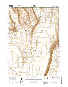
2014 Map of Steamboat Point
USGS Topo · Published 2014About this map
Steamboat Point stands as a prominent landmark overlooking the high desert landscape of Harney County, Oregon. This 2014 survey captures a sparsely populated region defined by its water management and distinct landforms. The arid valley floor is marked by essential water sources for livestock and local wildlife, including Drift Fence Waterhole and Middle Lake Waterhole, alongside the Chrome Reservoir. The terrain is characterized by dramatic vertical shifts at Kit Canyon and Orejana Canyon, which descend toward the broad expanse of Warner Valley in the south. Transportation in this remote area is primarily facilitated by Mule Spring Rd, which skirts the edge of Mule Springs Valley. The map detail highlights the intersection of public land management and natural topography, illustrating how water access remains the primary infrastructure in this part of the Oregon high desert.
Find a feature on this map
13 named features on this map. Tap any name to fly to it.
Don’t see what you’re looking for? This feature index may not catch every label — zoom into the map to look around manually.
Map Details
Editions of this 2014 Steamboat Point Map
This is the sole edition of this map. No revisions or reprints were ever made.
Other maps of this area

1955 · Adel
USGS Topo · 1:250,000

1957 · Adel
USGS Topo · 1:250,000

1958 · Adel
USGS Topo · 1:250,000

1962 · Adel
USGS Topo · 1:250,000

1966 · Bluejoint Lake East
USGS Topo · 1:24,000

1967 · Bluejoint Lake West
USGS Topo · 1:24,000

1971 · Steamboat Point
USGS Topo · 1:24,000

1971 · Orejana Canyon
USGS Topo · 1:24,000

1971 · Rock Camp Draw
USGS Topo · 1:24,000
1971 · Sixmile Draw
USGS Topo · 1:24,000