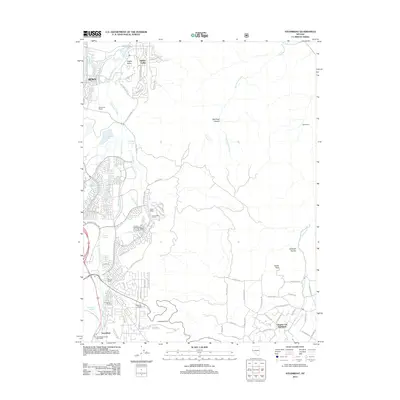
2012 Map of Steamboat
USGS Topo · Published 2012About this map
Steamboat Springs anchors the southern portion of this landscape, where the geothermal activity that defines the local geology is clearly marked alongside the Steamboat Branch Post Office. The area exhibits a distinct shift from the established residential pockets of Reno and Hidden Valley in the north toward more sprawling ranch lands and newer developments. A series of agricultural and equestrian-themed landmarks, including Bella Vista Ranch, Treps Farm, and Bianco Ranch, highlight the rural-to-suburban transition occurring south of the city. To the southeast, the terrain rises sharply toward the Virginia City Highlands, punctuated by high points like Castle Peak and Lookout Point. The network of irrigation and water management is evident through the path of Steamboat Creek and the Crane Ditch, which service the lower elevations before the land ascends into the dry canyons of Red Rock Canyon.
Find a feature on this map
80 named features on this map. Tap any name to fly to it.
Don’t see what you’re looking for? This feature index may not catch every label — zoom into the map to look around manually.
Map Details
Editions of this 2012 Steamboat Map
This is the sole edition of this map. No revisions or reprints were ever made.
Other maps of this area

1891 · Carson
USGS Topo · 1:125,000

1891 · Reno
USGS Topo · 1:125,000

1893 · Carson
USGS Topo · 1:125,000

1893 · Reno
USGS Topo · 1:125,000

1950 · Virginia City
USGS Topo · 1:62,500

1950 · Mt. Rose
USGS Topo · 1:62,500

1950 · Reno
USGS Topo · 1:62,500

1951 · Reno
USGS Topo · 1:62,500

1952 · Mt. Rose
USGS Topo · 1:62,500

1952 · Virginia City
USGS Topo · 1:62,500