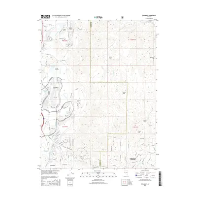
2015 Map of Steamboat
USGS Topo · Published 2015About this map
Reno expands into the southeastern foothills of the Virginia Range in this modern survey, where suburban development meets the steep, drainage-cut slopes of the Great Basin. The landscape is defined by the transition from the relatively flat Truckee Meadows to the high desert peaks, most notably at Castle Peak and Washington Hill. This area is historically significant for its geothermal activity and water resources, evidenced by a dense concentration of thermal features such as Steamboat Springs, Reno Hot Springs, and Alum Spring. The built environment shows a sophisticated network of modern thoroughfares like S McCarran Blvd and Veterans Pky alongside older water management infrastructure like Crane Ditch. To the southeast, the residential enclave of Virginia City Highlands sits near the Washoe and Storey county line, serving as a gateway toward the historic Comstock region via the winding Geiger DH Lookout Point.
Find a feature on this map
114 named features on this map. Tap any name to fly to it.
Don’t see what you’re looking for? This feature index may not catch every label — zoom into the map to look around manually.
Map Details
Editions of this 2015 Steamboat Map
This is the sole edition of this map. No revisions or reprints were ever made.
Other maps of this area

1891 · Carson
USGS Topo · 1:125,000

1891 · Reno
USGS Topo · 1:125,000

1893 · Carson
USGS Topo · 1:125,000

1893 · Reno
USGS Topo · 1:125,000

1950 · Virginia City
USGS Topo · 1:62,500

1950 · Mt. Rose
USGS Topo · 1:62,500

1950 · Reno
USGS Topo · 1:62,500

1951 · Reno
USGS Topo · 1:62,500

1952 · Mt. Rose
USGS Topo · 1:62,500

1952 · Virginia City
USGS Topo · 1:62,500