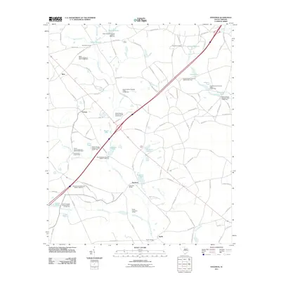
2011 Map of Steedman
USGS Topo · Published 2011About this map
The North Fork Edisto River forms a central drainage for this section of Lexington County, where a network of family-named millponds and creeks defines the agricultural and rural character of the region. The map reveals a landscape heavily influenced by water management, with numerous named features such as Abells Millpond, Hallman Millpond, and Brodie Millpond indicating a long history of local industry. Small communities like Steedman and Samaria serve as local hubs, connected by historic routes including Two Notch Rd and Pond Branch Rd. For those researching local heritage, the inclusion of the Old Rowe School and the Boatwright Cemetery provides specific points for genealogical study. The presence of Camp Kinard and Camp Clark further highlights the area's role in communal and recreational land use during this period.
Find a feature on this map
119 named features on this map. Tap any name to fly to it.
Don’t see what you’re looking for? This feature index may not catch every label — zoom into the map to look around manually.
Map Details
Editions of this 2011 Steedman Map
This is the sole edition of this map. No revisions or reprints were ever made.
Other maps of this area

1920 · Aiken
USGS Topo · 1:48,000

1921 · Aiken
USGS Topo · 1:62,500

1943 · Aiken
USGS Topo · 1:62,500

1944 · Gilbert
USGS Topo · 1:62,500

1944 · Seivern
USGS Topo · 1:62,500

1954 · Augusta
USGS Topo · 1:250,000

1957 · Augusta
USGS Topo · 1:250,000

1958 · Augusta
USGS Topo · 1:250,000

1961 · Augusta
USGS Topo · 1:250,000

1962 · Augusta
USGS Topo · 1:250,000