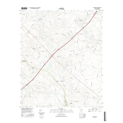
2017 Map of Steedman
USGS Topo · Published 2017About this map
Steedman and the surrounding borderlands of Lexington and Aiken Counties are defined by the winding course of the North Edisto River and its numerous tributaries. The landscape is dotted with legacy water features that reflect a history of local milling and agriculture, including Abells Millpond, Brodie Millpond, and Hallman Millpond. The settlement pattern centers on small rural communities like Samaria and Rayflin, while cultural landmarks such as the Old Rowe School and the Francis Cyril Jones Bridge anchor the area's social geography. Local family histories are preserved through several rural burial grounds, including Boatwright Cem and Bethlehem Cem. The transit network is a mix of traditional county roads like Old Chalk Bed Rd and modern corridors, illustrating how this South Carolina Piedmont area has balanced its agrarian roots with increasing regional connectivity.
Find a feature on this map
114 named features on this map. Tap any name to fly to it.
Don’t see what you’re looking for? This feature index may not catch every label — zoom into the map to look around manually.
Map Details
Editions of this 2017 Steedman Map
This is the sole edition of this map. No revisions or reprints were ever made.
Other maps of this area

1920 · Aiken
USGS Topo · 1:48,000

1921 · Aiken
USGS Topo · 1:62,500

1943 · Aiken
USGS Topo · 1:62,500

1944 · Gilbert
USGS Topo · 1:62,500

1944 · Seivern
USGS Topo · 1:62,500

1954 · Augusta
USGS Topo · 1:250,000

1957 · Augusta
USGS Topo · 1:250,000

1958 · Augusta
USGS Topo · 1:250,000

1961 · Augusta
USGS Topo · 1:250,000

1962 · Augusta
USGS Topo · 1:250,000