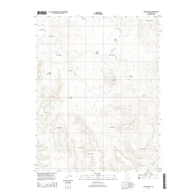
2014 Map of Steele Butte
USGS Topo · Published 2014About this map
Steele Butte and the surrounding high plateau of Tarantula Mesa define this remote section of Garfield County during the early 21st century. The landscape is characterized by a series of dramatic benches and mesas, including Wildcat Mesa and Pete Steele Bench, which separate deep drainages such as Five Canyon and Coleman Hollow Wash. The network of backroads, including S Creek Rd and Tarantula Mesa Rd, reveals how this territory is accessed across shifting elevations.
Find a feature on this map
29 named features on this map. Tap any name to fly to it.
Don’t see what you’re looking for? This feature index may not catch every label — zoom into the map to look around manually.
Map Details
Editions of this 2014 Steele Butte Map
This is the sole edition of this map. No revisions or reprints were ever made.
Other maps of this area

1885 · San Rafael
USGS Topo · 1:250,000

1885 · Fish Lake
USGS Topo · 1:250,000

1886 · Escalante
USGS Topo · 1:250,000

1886 · Henry Mountains
USGS Topo · 1:250,000

1892 · Henry Mountains
USGS Topo · 1:250,000

1896 · Fish Lake
USGS Topo · 1:250,000

1952 · Notom 4 SE
USGS Topo · 1:24,000

1952 · Mt Pennell 2 NE
USGS Topo · 1:24,000

1952 · Notom 4 NE
USGS Topo · 1:24,000

1952 · Notom
USGS Topo · 1:62,500