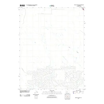
2010 Map of Steele Hollow
USGS Topo · Published 2010About this map
Steele Hollow defines the drainage patterns of this Colorado landscape, where intermittent waterways carve through the plains. The southern portion of the map reveals a dense network of residential development north of Williams Creek, marked by a modern grid of streets including E Hastings Ave and E Scandia Dr. This suburban expansion contrasts sharply with the open rangeland to the north, which is bisected by long, straight thoroughfares like Quail Rd and Antelope Rd. The natural geography is dominated by the winding paths of Porter Creek and Dry Creek, which converge as they flow toward the more settled areas. Researchers can observe the specific street-level growth of these neighborhoods, seeing how names like Will Rogers Dr and Rising Sun Dr have been integrated into the local topography.
Find a feature on this map
15 named features on this map. Tap any name to fly to it.
Don’t see what you’re looking for? This feature index may not catch every label — zoom into the map to look around manually.
Map Details
Editions of this 2010 Steele Hollow Map
This is the sole edition of this map. No revisions or reprints were ever made.
Other maps of this area

1891 · Pueblo
USGS Topo · 1:125,000

1893 · Colorado Springs
USGS Topo · 1:125,000

1894 · Pueblo
USGS Topo · 1:125,000

1896 · Pueblo
USGS Topo · 1:125,000

1897 · Pueblo
USGS Topo · 1:125,000

1909 · Colorado Springs
USGS Topo · 1:125,000

1942 · Colorado Springs
USGS Topo · 1:125,000

1948 · Timber Mountain
USGS Topo · 1:24,000

1948 · Fountain SE
USGS Topo · 1:24,000
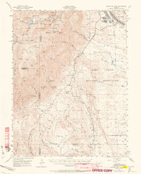
1948 · Mount Big Chief
USGS Topo · 1:62,500