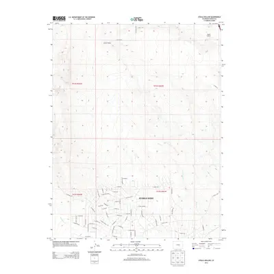
2013 Map of Steele Hollow
USGS Topo · Published 2013About this map
Pueblo West dominates the southern portion of this landscape, showcasing a modern residential grid expanding into the high plains of Pueblo County. The layout of the community is defined by major thoroughfares such as Platteville Blvd and E Jesse James Ave, which cut across the prairie to connect various neighborhoods. To the north, the terrain transitions into a more sparsely developed area characterized by significant drainage features including Steele Hollow and Young Hollow. These landforms, along with waterways like Porter Cr and Wild Horse Cr, dictate the natural topography and influence the modern road network. Local landmarks like N Gantts Fort Ave and Young Hollow Rd provide specific points of reference for residents and researchers tracking the suburban footprint of this High Plains community during the early 21st century.
Find a feature on this map
62 named features on this map. Tap any name to fly to it.
Don’t see what you’re looking for? This feature index may not catch every label — zoom into the map to look around manually.
Map Details
Editions of this 2013 Steele Hollow Map
This is the sole edition of this map. No revisions or reprints were ever made.
Other maps of this area

1891 · Pueblo
USGS Topo · 1:125,000

1893 · Colorado Springs
USGS Topo · 1:125,000

1894 · Pueblo
USGS Topo · 1:125,000

1896 · Pueblo
USGS Topo · 1:125,000

1897 · Pueblo
USGS Topo · 1:125,000

1909 · Colorado Springs
USGS Topo · 1:125,000

1942 · Colorado Springs
USGS Topo · 1:125,000

1948 · Timber Mountain
USGS Topo · 1:24,000

1948 · Fountain SE
USGS Topo · 1:24,000
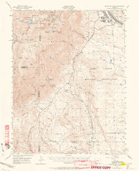
1948 · Mount Big Chief
USGS Topo · 1:62,500