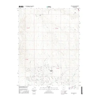
2016 Map of Steele Hollow
USGS Topo · Published 2016About this map
Pueblo West anchors the southern portion of this landscape, showing a suburban street network that pays homage to the Old West through its thematic naming conventions. Residential corridors such as N Billy The Kid Ln, N Jesse James Ln, and N Bat Masterson Ln suggest a community rooted in frontier lore. This development contrasts with the open terrain to the north, where the topography is defined by the significant drainages of Steele Hollow and Young Hollow. Several intermittent watercourses, including Porter Cr and Dry Cr, carve through the high plains toward Wild Horse Cr. The northern sections remain largely undeveloped, with long straight-line roads like Quail Rd and Antelope Rd marking the transition into more rural Pueblo County acreage.
Find a feature on this map
91 named features on this map. Tap any name to fly to it.
Don’t see what you’re looking for? This feature index may not catch every label — zoom into the map to look around manually.
Map Details
Editions of this 2016 Steele Hollow Map
This is the sole edition of this map. No revisions or reprints were ever made.
Other maps of this area

1891 · Pueblo
USGS Topo · 1:125,000

1893 · Colorado Springs
USGS Topo · 1:125,000

1894 · Pueblo
USGS Topo · 1:125,000

1896 · Pueblo
USGS Topo · 1:125,000

1897 · Pueblo
USGS Topo · 1:125,000

1909 · Colorado Springs
USGS Topo · 1:125,000

1942 · Colorado Springs
USGS Topo · 1:125,000

1948 · Timber Mountain
USGS Topo · 1:24,000

1948 · Fountain SE
USGS Topo · 1:24,000
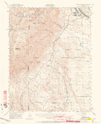
1948 · Mount Big Chief
USGS Topo · 1:62,500