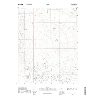
2019 Map of Steele Hollow
USGS Topo · Published 2019About this map
Steele Hollow and the surrounding terrain of Pueblo County illustrate a landscape in transition, where high desert plateaus meet suburban expansion. In the northern sections, the topography is defined by the natural drainages of Young Hollow and its namesake namesake, while the southern half shows the organized grid of a developing residential area. This shift is clear along E Purcell Blvd and E Platteville Blvd N, which serve as primary corridors through these high-plains neighborhoods. Water management is a visible priority here, with the paths of Porter Cr, Dry Cr, and Wild Horse Cr carefully integrated into the survey. For researchers, the map provides a precise layout of modern street names and local landmarks like Stoneage Rd and Young Hollow Rd as they existed during this period of growth.
Find a feature on this map
87 named features on this map. Tap any name to fly to it.
Don’t see what you’re looking for? This feature index may not catch every label — zoom into the map to look around manually.
Map Details
Editions of this 2019 Steele Hollow Map
This is the sole edition of this map. No revisions or reprints were ever made.
Other maps of this area

1891 · Pueblo
USGS Topo · 1:125,000

1893 · Colorado Springs
USGS Topo · 1:125,000

1894 · Pueblo
USGS Topo · 1:125,000

1896 · Pueblo
USGS Topo · 1:125,000

1897 · Pueblo
USGS Topo · 1:125,000

1909 · Colorado Springs
USGS Topo · 1:125,000

1942 · Colorado Springs
USGS Topo · 1:125,000

1948 · Timber Mountain
USGS Topo · 1:24,000

1948 · Fountain SE
USGS Topo · 1:24,000
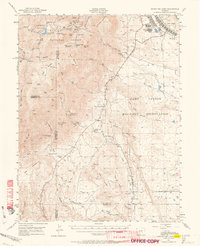
1948 · Mount Big Chief
USGS Topo · 1:62,500