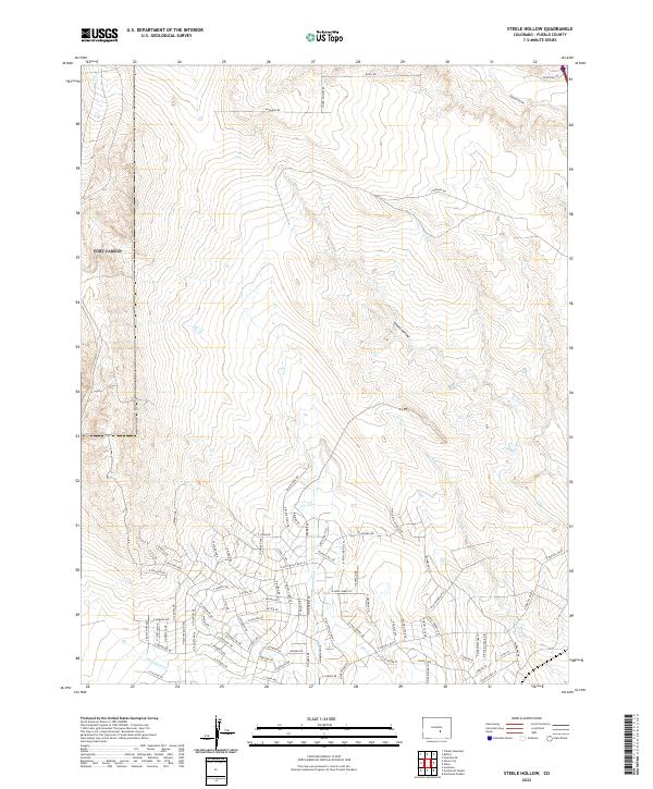
2022 Map of Steele Hollow
USGS Topo · Published 2022About this map
Steele Hollow and its surrounding drainages characterize this portion of Pueblo County, where high plains topography meets expanding residential grids. The landscape is defined by the ephemeral courses of Porter Cr, Dry Cr, and Wild Horse Cr, which carve shallow paths toward the southeast. These natural features contrast with a modern street network named for frontier figures and western history. Names like N Will Bill Hickock Dr, N Billy The Kid Ln, and Buffalo Bill Ln reflect a conscious thematic development style as the area transitions from open range to a suburban footprint. The map also captures the topography of Young Hollow and Bear Gulch, alongside arterial routes like N Purcell Blvd that serve this growing corridor.
Find a feature on this map
90 named features on this map. Tap any name to fly to it.
Don’t see what you’re looking for? This feature index may not catch every label — zoom into the map to look around manually.
Map Details
Editions of this 2022 Steele Hollow Map
This is the sole edition of this map. No revisions or reprints were ever made.
Other maps of this area

1891 · Pueblo
USGS Topo · 1:125,000

1893 · Colorado Springs
USGS Topo · 1:125,000

1894 · Pueblo
USGS Topo · 1:125,000

1896 · Pueblo
USGS Topo · 1:125,000

1897 · Pueblo
USGS Topo · 1:125,000

1909 · Colorado Springs
USGS Topo · 1:125,000

1942 · Colorado Springs
USGS Topo · 1:125,000

1948 · Timber Mountain
USGS Topo · 1:24,000

1948 · Fountain SE
USGS Topo · 1:24,000
1948 · Mount Big Chief
USGS Topo · 1:62,500