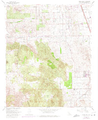
1967 Map of Steele Peak
USGS Topo · Published 1975About this map
March Air Force Base occupies the northeast corner of this terrain, where the early suburban grid of Val Verde meets the technical infrastructure of the Colorado River Aqueduct. The landscape is a study in 1960s California land use, transitioning from the organized aviation and agricultural zones in the north to the mining-scarred highlands of the Gavilan Plateau to the south. Several historical mining operations, including the Gavilan Mine, Ida Leona Mine, and Santa Rosa Mine, are etched into the hillsides alongside the Rancho de las Piedras. To the southeast, the growing settlement of Perris begins to expand toward Steele Peak and the Maywood Rod and Gun Club. Transportation networks are heavily represented by the Atchison Topeka and Santa Fe railroad line and a dense network of country roads such as Cajalco Road and Nandina Ave.
Find a feature on this map
48 named features on this map. Tap any name to fly to it.
Don’t see what you’re looking for? This feature index may not catch every label — zoom into the map to look around manually.
Map Details
Editions of this 1967 Steele Peak Map
3 editions found
Other maps of this area

1901 · Southern California Sheet No. 1
USGS Topo · 1:250,000

1901 · Elsinore
USGS Topo · 1:125,000

1901 · Riverside
USGS Topo · 1:62,500

1904 · Southern California Sheet No. 1
USGS Topo · 1:250,000

1942 · Lake Elsinore
USGS Topo · 1:62,500
1942 · Riverside and Vicinity
USGS Topo · 1:31,680

1942 · Murrieta
USGS Topo · 1:62,500

1942 · Riverside
USGS Topo · 1:62,500

1942 · Perris
USGS Topo · 1:62,500

1943 · Perris
USGS Topo · 1:62,500