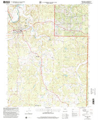
1999 Map of Steelville
USGS Topo · Published 2002About this map
The Meramec River flows through the northwest corner of this Crawford County landscape, where the settlement of Steelville serves as a central hub. This survey illustrates a rural community anchored by its public institutions and industrial history, notably the Steelville R-3 High Sch and the Midland Mine to the north. The terrain is marked by numerous family and community landmarks, including Yackey Cem and the Center Point Ch, reflecting a deep-rooted social fabric that spans from the riverbanks to the interior highlands.
Find a feature on this map
34 named features on this map. Tap any name to fly to it.
Don’t see what you’re looking for? This feature index may not catch every label — zoom into the map to look around manually.
Map Details
Editions of this 1999 Steelville Map
This is the sole edition of this map. No revisions or reprints were ever made.
Other maps of this area

1903 · Sullivan
USGS Topo · 1:125,000

1932 · Steelville
USGS Topo · 1:48,000

1933 · Steelville
USGS Topo · 1:62,500

1937 · Steelville
USGS Topo · 1:62,500

1943 · Berryman
USGS Topo · 1:62,500

1945 · Berryman
USGS Topo · 1:62,500

1947 · Sullivan
USGS Topo · 1:62,500

1948 · Cuba
USGS Topo · 1:24,000

1948 · Leasburg
USGS Topo · 1:24,000

1949 · Saint Louis
USGS Topo · 1:250,000