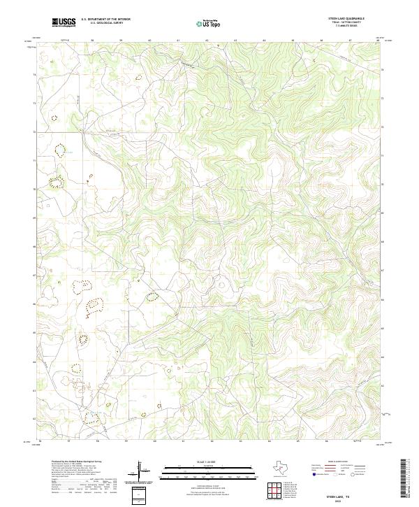
2022 Map of Steen Lake
USGS Topo · Published 2022About this map
The Edwards Plateau landscape in Sutton County is defined by a sparse network of ranch roads and ephemeral water features, characteristic of this West Texas region. Steen Lake and Lost Lake serve as primary landmarks in a terrain marked by subtle depressions and drainage systems like Eightmile Draw. The map reveals a land management pattern dominated by private access, indicated by a high density of numbered routes such as Pvt Rd 3340, Pvt Rd 3342, and Pvt Rd 3345. Public access is limited to thoroughfares like Ranch Rd 3130 and Ross Rd. This 2022 survey documents the contemporary parceling and connectivity of these large ranching tracts, where the relationship between seasonal water sources and transportation infrastructure remains central to the area's geography.
Find a feature on this map
16 named features on this map. Tap any name to fly to it.
Don’t see what you’re looking for? This feature index may not catch every label — zoom into the map to look around manually.
Map Details
Editions of this 2022 Steen Lake Map
This is the sole edition of this map. No revisions or reprints were ever made.
Other maps of this area

1893 · Rock Springs
USGS Topo · 1:125,000

1893 · Fort McKavett
USGS Topo · 1:125,000

1954 · Sonora
USGS Topo · 1:250,000

1958 · Sonora
USGS Topo · 1:250,000

1962 · Stewart Ranch
USGS Topo · 1:24,000

1963 · Steen Lake
USGS Topo · 1:24,000

1963 · Harrison Ranch
USGS Topo · 1:24,000

1963 · Live Oak Draw
USGS Topo · 1:24,000

1963 · Buffalo Well SE
USGS Topo · 1:24,000

1963 · Buffalo Well SW
USGS Topo · 1:24,000