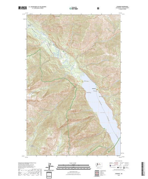
2023 Map of Stehekin
USGS Topo · Published 2023About this map
Lake Chelan terminates at the small settlement of Stehekin, a hub defined by its isolation and the deep glaciated valley of the Stehekin River. This modern survey details the primary access points for the community, including the Lake Chelan Ferry route and the Stehekin State Airport. The surrounding landscape is dominated by the Stephen Mather Wilderness and the Glacier Peak Wilderness, where the topography rises sharply to Rainbow Mtn and the Fourth of July Basin.
Find a feature on this map
67 named features on this map. Tap any name to fly to it.
Don’t see what you’re looking for? This feature index may not catch every label — zoom into the map to look around manually.
Map Details
Editions of this 2023 Stehekin Map
This is the sole edition of this map. No revisions or reprints were ever made.
Other maps of this area

1902 · Stehekin
USGS Topo · 1:125,000

1904 · Stehekin
USGS Topo · 1:125,000

1944 · Holden
USGS Topo · 1:62,500

1944 · Lucerne
USGS Topo · 1:62,500

1949 · Lucerne
USGS Topo · 1:62,500

1949 · Holden
USGS Topo · 1:62,500

1955 · Concrete
USGS Topo · 1:250,000

1958 · Concrete
USGS Topo · 1:250,000

1962 · Concrete
USGS Topo · 1:250,000

1963 · Mc Gregor Mtn
USGS Topo · 1:24,000