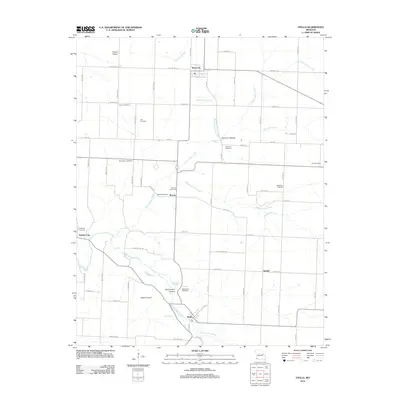
2012 Map of Stella
USGS Topo · Published 2012About this map
Stella serves as a focal point for this landscape in southwest Missouri, situated where South Indian Creek winds through the southern terrain. This 2012 survey documents a rural mosaic of small settlements and family burial grounds, including Stark City in the north and the crossroads of Wanda. The region is defined by its numerous springs and branches, such as Macedonia Spring and Weatherspoon Branch, which feed into the larger creek systems.
Find a feature on this map
46 named features on this map. Tap any name to fly to it.
Don’t see what you’re looking for? This feature index may not catch every label — zoom into the map to look around manually.
Map Details
Editions of this 2012 Stella Map
This is the sole edition of this map. No revisions or reprints were ever made.
Other maps of this area

1916 · Neosho
USGS Topo · 1:62,500

1940 · Noel
USGS Topo · 1:62,500

1941 · Rocky Comfort
USGS Topo · 1:62,500

1943 · Ritchey
USGS Topo · 1:62,500

1943 · Noel
USGS Topo · 1:62,500

1943 · Rocky Comfort
USGS Topo · 1:62,500

1954 · Tulsa
USGS Topo · 1:250,000

1958 · Tulsa
USGS Topo · 1:250,000

1963 · Tulsa
USGS Topo · 1:250,000
1972 · Granby
USGS Topo · 1:24,000