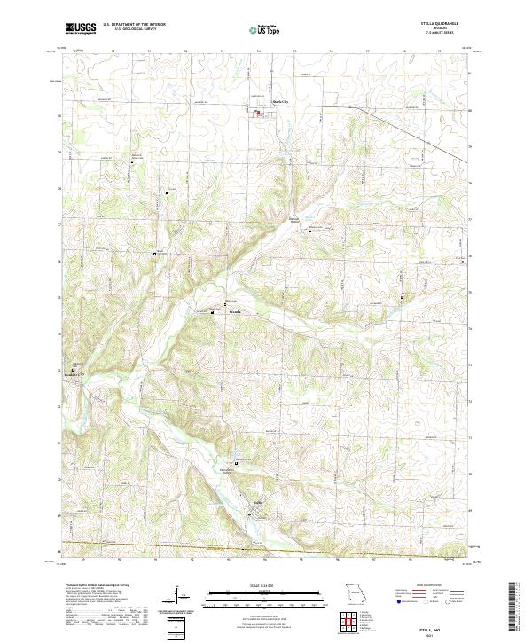
2021 Map of Stella
USGS Topo · Published 2021About this map
Stella and the surrounding high ground of the Newton and McDonald county line are defined by a complex network of spring-fed valleys. These deep recesses, including Shannon Hollow and Edmondson Hollow, feed into various branches of Indian Creek and Middle Indian Creek. The settlement pattern follows the ridges and valley floors, with small communities like Stark City, Wanda, and Boulder City serving as local anchors. For those researching family history in this corner of the Ozarks, the map provides a remarkable concentration of burial grounds, ranging from the William M Brown Cem in the north to the Macedonia Cem near Macedonia Spring. The terrain is etched with numerous named waterways such as Stedman Br, Huffman Br, and Newtonia Br, which illustrate the region's intricate drainage system.
Find a feature on this map
75 named features on this map. Tap any name to fly to it.
Don’t see what you’re looking for? This feature index may not catch every label — zoom into the map to look around manually.
Map Details
Editions of this 2021 Stella Map
This is the sole edition of this map. No revisions or reprints were ever made.
Other maps of this area

1916 · Neosho
USGS Topo · 1:62,500

1940 · Noel
USGS Topo · 1:62,500

1941 · Rocky Comfort
USGS Topo · 1:62,500

1943 · Ritchey
USGS Topo · 1:62,500

1943 · Noel
USGS Topo · 1:62,500

1943 · Rocky Comfort
USGS Topo · 1:62,500

1954 · Tulsa
USGS Topo · 1:250,000

1958 · Tulsa
USGS Topo · 1:250,000

1963 · Tulsa
USGS Topo · 1:250,000
1972 · Granby
USGS Topo · 1:24,000