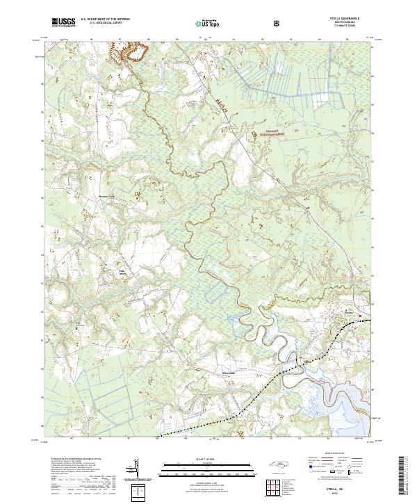
2022 Map of Stella
USGS Topo · Published 2022About this map
The White Oak River serves as the central artery for this region, winding through the coastal wetlands along the boundary of Croatan National Forest. Small communities and family settlements are scattered throughout the landscape, including Silverdale, Stella, and Morton Fork, connected by a network of rural roads such as Belgrade Swansboro Rd. This area reflects the modern management of historical woodlands, where recreational paths like the Saltwater Adventure Trl and Weetock Trl now trace routes through the dense vegetation of Black Swamp Cr and Starkys Cr. Local genealogy is anchored by landmarks like the Riggs / Jones Cem, situated near the headwaters of Grants Cr. The map captures a point where three counties—Onslow, Jones, and Carteret—converge amidst a complex system of creeks and branches that have historically defined property lines and travel in eastern North Carolina.
Find a feature on this map
65 named features on this map. Tap any name to fly to it.
Don’t see what you’re looking for? This feature index may not catch every label — zoom into the map to look around manually.
Map Details
Editions of this 2022 Stella Map
This is the sole edition of this map. No revisions or reprints were ever made.
Other maps of this area

1942 · Maysville
USGS Topo · 1:62,500

1942 · Swansboro
USGS Topo · 1:62,500

1943 · Jacksonville
USGS Topo · 1:62,500

1948 · Maysville
USGS Topo · 1:62,500

1948 · Swansboro
USGS Topo · 1:62,500

1948 · New River
USGS Topo · 1:62,500

1952 · Hubert
USGS Topo · 1:24,000

1952 · Camp Lejeune
USGS Topo · 1:24,000

1952 · Swansboro
USGS Topo · 1:24,000

1953 · Beaufort
USGS Topo · 1:250,000