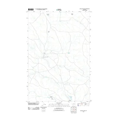
2011 Map of Stellar Lake
USGS Topo · Published 2011About this map
Little Porcupine Creek and Cherry Creek wind through this part of Rosebud County, defining a landscape shaped by water management and ranching. The presence of numerous small-scale water projects, including Cherry Creek Number 23 Dam, Brooks Number 2 Dam, and Twin Dam Number 1, indicates a sophisticated effort to capture runoff in this semi-arid environment. These dams and reservoirs, such as Wagner Reservoir and the namesake Stellar Lake, serve as critical infrastructure for the region's agricultural viability.
Find a feature on this map
13 named features on this map. Tap any name to fly to it.
Don’t see what you’re looking for? This feature index may not catch every label — zoom into the map to look around manually.
Map Details
Editions of this 2011 Stellar Lake Map
This is the sole edition of this map. No revisions or reprints were ever made.
Other maps of this area

1954 · Forsyth
USGS Topo · 1:250,000

1957 · Forsyth
USGS Topo · 1:250,000

1958 · Forsyth
USGS Topo · 1:250,000

1965 · Black Hills
USGS Topo · 1:24,000

1965 · Needle Butte Reservoir
USGS Topo · 1:24,000
1965 · Mother Butte
USGS Topo · 1:24,000
1965 · Antelope Springs
USGS Topo · 1:24,000

1965 · Vanstel
USGS Topo · 1:24,000

1965 · Stellar Lake
USGS Topo · 1:24,000

1969 · Rudie Coulee
USGS Topo · 1:24,000