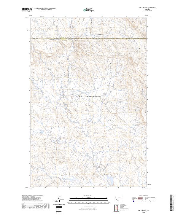
2024 Map of Stellar Lake
USGS Topo · Published 2024About this map
Wagner Reservoir and the winding course of Little Porcupine Creek anchor this landscape along the boundary of Garfield and Rosebud counties. The terrain is defined by a dense network of coulees and draws, illustrating the intricate drainage patterns that characterize this portion of the Montana plains. Named drainages such as Russian Frank Coulee and Hoff Coulee cut through the high ground, leading toward larger watercourses like Cherry Creek and Coyote Creek. This modern survey by the U.S. Geological Survey provides a precise view of the land's relief, showing the subtle elevation changes and the specific path of Engine Draw in the northern reaches of the quadrangle. The sparse distribution of named features reflects the remote, open character of the region, where water management and natural drainage are the primary markers of human and geological presence.
Find a feature on this map
11 named features on this map. Tap any name to fly to it.
Don’t see what you’re looking for? This feature index may not catch every label — zoom into the map to look around manually.
Map Details
Editions of this 2024 Stellar Lake Map
This is the sole edition of this map. No revisions or reprints were ever made.
Other maps of this area

1954 · Forsyth
USGS Topo · 1:250,000

1957 · Forsyth
USGS Topo · 1:250,000

1958 · Forsyth
USGS Topo · 1:250,000

1965 · Black Hills
USGS Topo · 1:24,000

1965 · Needle Butte Reservoir
USGS Topo · 1:24,000
1965 · Mother Butte
USGS Topo · 1:24,000
1965 · Antelope Springs
USGS Topo · 1:24,000

1965 · Vanstel
USGS Topo · 1:24,000

1965 · Stellar Lake
USGS Topo · 1:24,000

1969 · Rudie Coulee
USGS Topo · 1:24,000