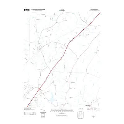
2013 Map of Stem
USGS Topo · Published 2013About this map
Stem and its surrounding communities in Granville County are defined by a network of small creeks feeding into the Tar River in this 2013 landscape. The settlement pattern follows historical corridors like Old NC 75, where smaller hamlets such as Shoofly and Hester occupy the high ground between drainage basins. To the south, the community of Lyons sits near the headwaters of Little Ledge Cr, while the shoreline of Caldmont Lake provides a distinct hydrological feature amidst the area's many tributary streams like Holman Cr and Ledge Cr. The map reveals a transition from these established nodes toward the southeastern edge at Mount Energy, illustrating how modern road developments intersect with traditional rural North Carolina boundaries and family-named landmarks like Jack Clement Rd and Bryans Hill Rd.
Find a feature on this map
122 named features on this map. Tap any name to fly to it.
Don’t see what you’re looking for? This feature index may not catch every label — zoom into the map to look around manually.
Map Details
Editions of this 2013 Stem Map
This is the sole edition of this map. No revisions or reprints were ever made.
Other maps of this area

1943 · Roxboro
USGS Topo · 1:62,500

1943 · Creedmoor
USGS Topo · 1:62,500

1944 · Creedmoor
USGS Topo · 1:62,500

1951 · Durham North
USGS Topo · 1:62,500

1953 · Oxford
USGS Topo · 1:62,500

1953 · Greensboro
USGS Topo · 1:250,000

1954 · Greensboro
USGS Topo · 1:250,000

1962 · Greensboro
USGS Topo · 1:250,000

1966 · Greensboro
USGS Topo · 1:250,000

1966 · Oxford
USGS Topo · 1:62,500