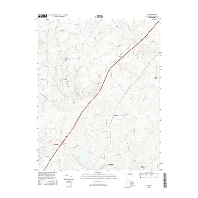
2016 Map of Stem
USGS Topo · Published 2016About this map
Stem and Hester sit at the center of this Granville County landscape, where the rolling Piedmont terrain is defined by a dense network of tributary creeks. The area is heavily intersected by transportation corridors, from the historic route of Railroad Ave in Butner to the modern highway system that divides the watersheds of Aycock Cr and Ledge Cr. To the south, the larger settlement of Creedmoor borders the map, while smaller communities like Lyons and Shoofly maintain their distinct identities amidst the rural surroundings. Local landmarks such as Caldmont Lake and Community Memorial Gardens provide clear points of reference for those tracing family history or property boundaries. The northeastern corner is dominated by the winding course of the Tar River, which serves as a major geographical anchor for the region's topography and drainage patterns.
Find a feature on this map
90 named features on this map. Tap any name to fly to it.
Don’t see what you’re looking for? This feature index may not catch every label — zoom into the map to look around manually.
Map Details
Editions of this 2016 Stem Map
This is the sole edition of this map. No revisions or reprints were ever made.
Other maps of this area

1943 · Roxboro
USGS Topo · 1:62,500

1943 · Creedmoor
USGS Topo · 1:62,500

1944 · Creedmoor
USGS Topo · 1:62,500

1951 · Durham North
USGS Topo · 1:62,500

1953 · Oxford
USGS Topo · 1:62,500

1953 · Greensboro
USGS Topo · 1:250,000

1954 · Greensboro
USGS Topo · 1:250,000

1962 · Greensboro
USGS Topo · 1:250,000

1966 · Greensboro
USGS Topo · 1:250,000

1966 · Oxford
USGS Topo · 1:62,500