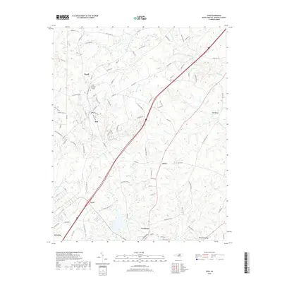
2019 Map of Stem
USGS Topo · Published 2019About this map
Stem and Creedmoor anchor this portion of Granville County, reflecting a landscape defined by small Piedmont settlements and an intricate network of waterways. The Tar River flows through the eastern edge of the quadrangle, joined by tributaries such as Aycock Cr and Johnson Cr. This 2019 survey shows the area's development around established crossroads like Hester and Shoofly, where family-named roads such as Thad Carey Rd and Sam Moss Hayes Rd connect dispersed homesteads to the town centers. In the southern reach, the edge of Butner and the settlement of Lyons illustrate the continued importance of the rail-and-road corridor that bisects the region. The map also identifies local landmarks like Community Memorial Gardens and the waters of Caldmont Lake, providing a clear look at the residential and rural balance of the early twenty-first century.
Find a feature on this map
99 named features on this map. Tap any name to fly to it.
Don’t see what you’re looking for? This feature index may not catch every label — zoom into the map to look around manually.
Map Details
Editions of this 2019 Stem Map
This is the sole edition of this map. No revisions or reprints were ever made.
Other maps of this area

1943 · Roxboro
USGS Topo · 1:62,500

1943 · Creedmoor
USGS Topo · 1:62,500

1944 · Creedmoor
USGS Topo · 1:62,500

1951 · Durham North
USGS Topo · 1:62,500

1953 · Oxford
USGS Topo · 1:62,500

1953 · Greensboro
USGS Topo · 1:250,000

1954 · Greensboro
USGS Topo · 1:250,000

1962 · Greensboro
USGS Topo · 1:250,000

1966 · Greensboro
USGS Topo · 1:250,000

1966 · Oxford
USGS Topo · 1:62,500