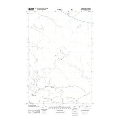
2011 Map of Stemple Pass
USGS Topo · Published 2011About this map
Stemple Pass serves as a critical geographic marker in this section of the Continental Divide, where the rugged drainages of the Blackfoot River meet the intricate network of headwater creeks. This 2011 survey reveals a landscape deeply marked by its mining history, evidenced by numerous named claims and operations like the Alpha-Omega Mine, Astor Mine, and the Pangewasset Mine. The distribution of these sites along Gould Creek and Virginia Creek suggests a legacy of prospecting that followed the narrow gulches. Water management for these operations is visible through features like the Pilgeram Ditch, which cuts across the terrain near Bear Gulch. The primitive road network, including Stemple Pass Rd and Horse Fly Creek Rd, highlights how access to these remote mining claims has been maintained through the decades.
Find a feature on this map
32 named features on this map. Tap any name to fly to it.
Don’t see what you’re looking for? This feature index may not catch every label — zoom into the map to look around manually.
Map Details
Editions of this 2011 Stemple Pass Map
This is the sole edition of this map. No revisions or reprints were ever made.
Other maps of this area

1889 · Helena
USGS Topo · 1:250,000

1893 · Helena
USGS Topo · 1:250,000

1899 · Helena
USGS Topo · 1:250,000

1903 · Coopers Lake
USGS Topo · 1:125,000

1903 · Helena
USGS Topo · 1:250,000

1943 · Hogan
USGS Topo · 1:125,000

1947 · Butte
USGS Topo · 1:250,000

1955 · Choteau
USGS Topo · 1:250,000

1957 · Choteau
USGS Topo · 1:250,000

1958 · Butte
USGS Topo · 1:250,000