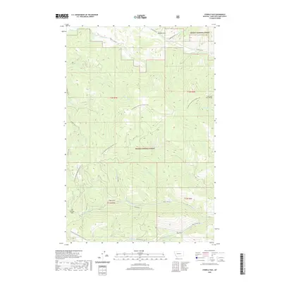
2020 Map of Stemple Pass
USGS Topo · Published 2020About this map
The Stemple Pass summit within the Helena National Forest serves as a critical waypoint for travelers navigating the crest of the Lewis and Clark Range. This modern survey reveals the high-altitude hydrology of the continental divide, where numerous seasonal and perennial headwaters such as Black Diamond Cr, Hogum Creek, and Rooster Bill Cr begin their descent toward the Blackfoot River or the Missouri basin.
Find a feature on this map
36 named features on this map. Tap any name to fly to it.
Don’t see what you’re looking for? This feature index may not catch every label — zoom into the map to look around manually.
Map Details
Editions of this 2020 Stemple Pass Map
This is the sole edition of this map. No revisions or reprints were ever made.
Other maps of this area

1889 · Helena
USGS Topo · 1:250,000

1893 · Helena
USGS Topo · 1:250,000

1899 · Helena
USGS Topo · 1:250,000

1903 · Coopers Lake
USGS Topo · 1:125,000

1903 · Helena
USGS Topo · 1:250,000

1943 · Hogan
USGS Topo · 1:125,000

1947 · Butte
USGS Topo · 1:250,000

1955 · Choteau
USGS Topo · 1:250,000

1957 · Choteau
USGS Topo · 1:250,000

1958 · Butte
USGS Topo · 1:250,000