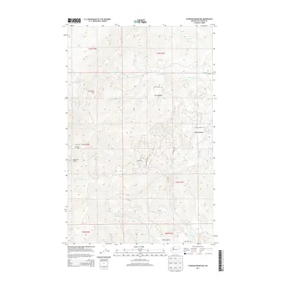
2014 Map of Stensgar Mountain
USGS Topo · Published 2014About this map
Stensgar Mtn and Huckleberry Mtn dominate this high-elevation landscape in Stevens County, where the topography is defined by a dense network of mountain drainages. The area is characterized by the convergence of numerous forks and creeks, including Huckleberry Cr, S Fork Harvey Cr, and the various branches of Deer Cr. Settlement is sparse, concentrated primarily at Carrs Corner and the open spaces of Klein Meadows to the north.
Find a feature on this map
31 named features on this map. Tap any name to fly to it.
Don’t see what you’re looking for? This feature index may not catch every label — zoom into the map to look around manually.
Map Details
Editions of this 2014 Stensgar Mountain Map
This is the sole edition of this map. No revisions or reprints were ever made.
Other maps of this area

1927 · Chewelah
USGS Topo · 1:125,000

1930 · Chewelah
USGS Topo · 1:125,000

1948 · Hunters
USGS Topo · 1:62,500

1950 · Hunters
USGS Topo · 1:62,500

1950 · Inchelium
USGS Topo · 1:62,500

1954 · Okanogan
USGS Topo · 1:250,000

1958 · Okanogan
USGS Topo · 1:250,000

1958 · Sandpoint
USGS Topo · 1:250,000

1963 · Sandpoint
USGS Topo · 1:250,000
1965 · Empey Mountain
USGS Topo · 1:24,000