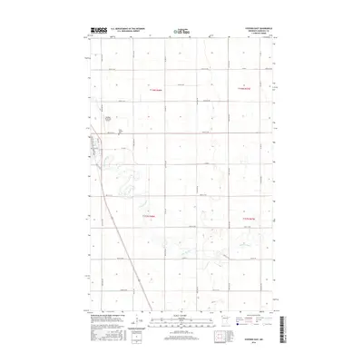
2016 Map of Stephen East
USGS Topo · Published 2016About this map
Stephen is the primary settlement on this Marshall County landscape, situated along the western edge where the local street grid of Atlantic Ave, Pacific Ave, and Fifth St meets the open agricultural plains. The town's local infrastructure is anchored by the Stephen Municipal Airport and the nearby Saint Stephen Cem. The surrounding territory is defined by a strictly surveyed section line grid, with roads such as Co Hwy 6 and 380th St NW spanning the prairie. Drainage and water management are critical features of this Red River Valley terrain, evidenced by the winding path of the Tamarac River and the engineered precision of Lateral Number One and Lateral Number Two. These man-made channels highlight the region's long-standing reliance on systematic water control to support its sprawling farmland.
Find a feature on this map
40 named features on this map. Tap any name to fly to it.
Don’t see what you’re looking for? This feature index may not catch every label — zoom into the map to look around manually.
Map Details
Editions of this 2016 Stephen East Map
This is the sole edition of this map. No revisions or reprints were ever made.
Other maps of this area

1918 · Argyle
USGS Topo · 1:62,500

1939 · Kennedy
USGS Topo · 1:62,500

1941 · Kennedy
USGS Topo · 1:62,500

1952 · Thief River Falls
USGS Topo · 1:250,000

1954 · Stephen
USGS Topo · 1:62,500

1956 · Thief River Falls
USGS Topo · 1:250,000

1956 · Karlstad
USGS Topo · 1:62,500

1956 · Florian
USGS Topo · 1:62,500

1957 · Thief River Falls
USGS Topo · 1:250,000

1967 · Thief River Falls
USGS Topo · 1:250,000