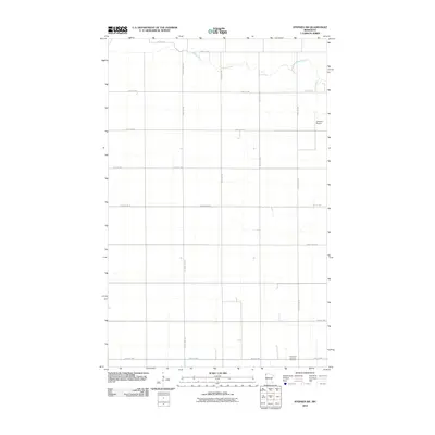
2010 Map of Stephen SW
USGS Topo · Published 2010About this map
Middle River meanders across the northern portion of this Marshall County landscape, defining the local drainage and topography in an otherwise highly organized agricultural grid. The terrain is dominated by a systematic network of section roads, including County Hwy-19 and County Hwy-21, which facilitate movement across this rural stretch of the Red River Valley. This 2010 survey reflects a modern period of rural infrastructure, where local aviation and small-scale community markers define the points of interest. Near the southeastern corner, the Immanuel Lutheran Cemetery serves as a significant genealogical landmark for area families. Further north, the Johnson Airport highlights the importance of private aviation in managing and monitoring the extensive farmland of Northwest Minnesota.
Find a feature on this map
20 named features on this map. Tap any name to fly to it.
Don’t see what you’re looking for? This feature index may not catch every label — zoom into the map to look around manually.
Map Details
Editions of this 2010 Stephen SW Map
This is the sole edition of this map. No revisions or reprints were ever made.
Other maps of this area

1918 · Acton
USGS Topo · 1:62,500

1918 · Argyle
USGS Topo · 1:62,500

1918 · Warren
USGS Topo · 1:62,500

1952 · Thief River Falls
USGS Topo · 1:250,000

1954 · Stephen
USGS Topo · 1:62,500

1955 · Warren
USGS Topo · 1:62,500

1956 · Thief River Falls
USGS Topo · 1:250,000

1957 · Thief River Falls
USGS Topo · 1:250,000
1966 · Big Woods NE
USGS Topo · 1:24,000
1966 · Oslo NE
USGS Topo · 1:24,000